While exploring Walton Country Park in Wakefield, I noticed what looked like a derelict railway bridge on Google Maps. I took my drone to take a closer look, and it did indeed appear to be railway-related.
- Caveat: These findings are my own, and they may not be accurate. If you have any other information, please share it with me.
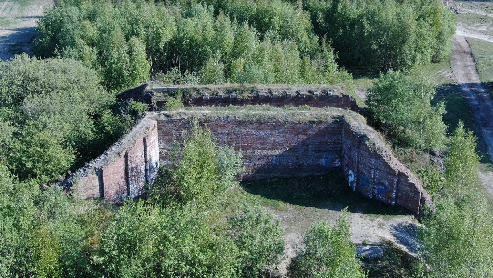
Looking at an old map, I saw that there was once a Crofton Junction at this location. This junction led to the Dearne Valley Railway, which was a 16-mile long line that ran from Wakefield to Mexborough. The railway was closed in 1964, but the bridge still stands today as a reminder of its former use.
I'm not sure why the bridge was built in such a remote location. Perhaps it was intended simply built to provide access to a nearby sewerage works. Whatever the reason, the bridge is a fascinating piece of history that is well worth a look on Google maps, or drone if you have one. I couldn't see any way to access this as it was all fenced off.
Here are some additional facts about the Dearne Valley Railway:
- The railway was built in 1864 by the North Eastern Railway.
- It was originally used to transport coal from the Dearne Valley to Wakefield.
- The railway was closed in 1964 as part of the Beeching Axe.
- The bridge at Walton Country Park is one of the few remaining structures from the Dearne Valley Railway.
Side by side map (link here for this)

Google map of the derelict bridge
You can zoom in and out of this one to get your bearings and see the bridge
Drone Video of the derelict railway bridge
Here is the drone video that I took of the derelict railway bridge next Walton Country Park
More cool places to fly your drone
For more cool, interesting and sometimes different places to visit in the UK (With or without a drone)
