The Arrow on Brean Down: A Reminder of World War II
Brean Down is a headland in Somerset, England, located about 9 miles (14 km) south of Weston-super-Mare. The headland is 170 meters (560 feet) high and is made up of limestone. Brean Down has a long history of human occupation, dating back to the Stone Age.
In the 1860s, a fort was built on Brean Down as part of a chain of coastal defenses known as the Palmerston Forts. The fort was never used in anger, but it was used for experimental weapons testing during World War II.
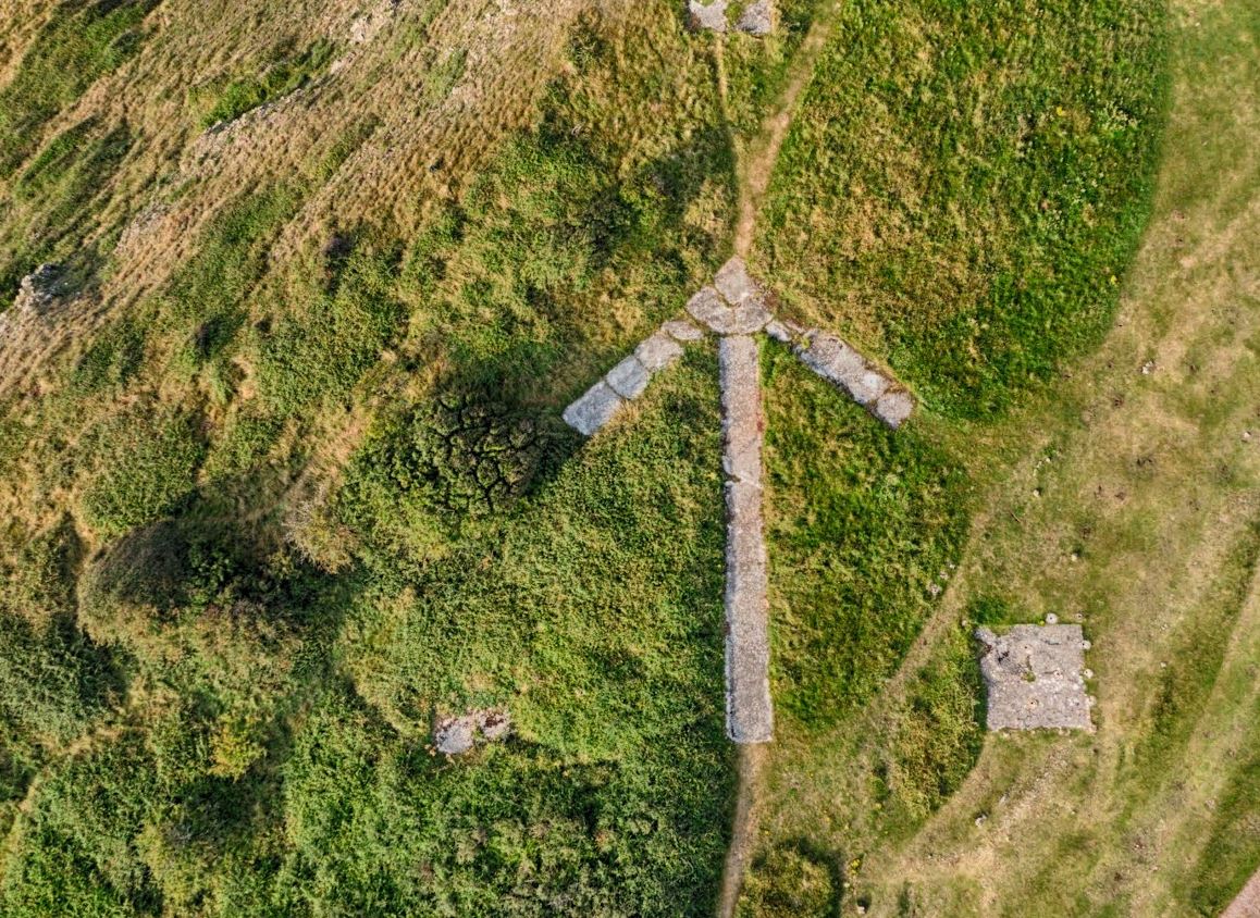
The most visible reminder of World War II on Brean Down is the arrow. The arrow is a concrete structure that was built in 1942 as a directional marker for trainee bomber pilots. It is about 100 feet long and is made up of 12 concrete slabs. The arrow is pointing in the direction of the bombing range that was located off the coast of Brean Down.
The bombing range was used by the Royal Air Force to train pilots in bombing techniques. The pilots would fly over the arrow and then drop their bombs on the targets that were located on the bombing range.
The arrow is no longer used for its original purpose, but it remains a visible reminder of the military activity that took place on Brean Down during World War II. It is a popular spot for tourists and is a listed building.
The arrow is a fascinating piece of history that is a reminder of the role that the area played in World War II. It is a popular spot for tourists and is a reminder of the importance of peace and security.
Drone Video of Brean Down and the Arrow
Map of Brean Down directional arrow
Photos that I took at Brean Down


More amazing places to visit in the UK
Here is a list of even more cool and sometimes slightly different places to visit in the UK
